
Datei:Bellingshausen Sea shaded, with the BAT.svg

Größe der PNG-Vorschau dieser SVG-Datei: 486 × 484 pixel. Ööder apliasangen: 241 × 240 pixel | 482 × 480 pixel | 771 × 768 pixel | 1.028 × 1.024 pixel | 2.056 × 2.048 pixel.
Originaal datei (SVG-datei, grate: 486 × 484 pixel, dateigrate: 4,77 MB)
Beskriiwang
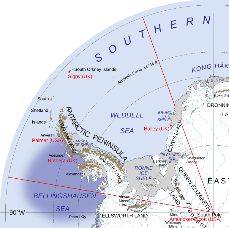
| Beskriiwang | The Bellinghausen Sea, shaded and with draft limits of the IHO o a map of the British Antarctic Territory | |||||
| Dootem | ||||||
| Kwel |
Draft IHO limits of Bellingshausen Sea (page 13–14) File:Map of Queen Elizabeth Land, BAT.svg |
|||||
| Skriiwer of Konstler | Hogweard | |||||
| Ferloof (Hü det datei brükt woort) |
|

Datei wersioonen
Klike üüb en tidjponkt, am detdiar wersion uuntulukin.
| Dootem/Tidj | Föörskaubil | Miaten | Brüker | Komentaar | |
|---|---|---|---|---|---|
| aktuel | 22:00, 25. Jan. 2020 | | 486 × 484 (4,77 MB) | Hogweard | Typo |
| 00:56, 23. Jan. 2020 |  | 486 × 484 (4,99 MB) | Hogweard | {{Information |description=The Bellinghausen Sea, shaded, showing the British Antarctic Territory |date=2020-01-22 |source={{f|Map of Queen Elizabeth Land, BAT.svg}} |author={{u|Hogweard}} |permission={{PD-USGov-NASA}} |other_versions= |other_fields= }} Category:Maps of the British Antarctic Territory Category:Bellingshausen Sea |
Hü det datei brükt woort
Detdiar sidj brükt detdiar datei: